文章目录
- 1、添加各种控制面板
- 1.1、添加全屏
- 1.2、缩放旋转控制
- 1.3、比例尺
- 2、获取并显示鼠标移动位置的经纬度坐标
- 3、添加图标
- 3.1、添加图片图层的图标
- 3.2、添加带有标记的自定义图标
- 3.3、悬停时显示弹出窗口
1、添加各种控制面板
1.1、添加全屏
      //添加全屏控制
      this.map.addControl(new this.$mapboxgl.FullscreenControl());
1.2、缩放旋转控制
      // Add zoom and rotation controls to the map.
      this.map.addControl(new this.$mapboxgl.NavigationControl());
1.3、比例尺
      // Add a scale control to the map
      this.map.addControl(new this.$mapboxgl.ScaleControl());
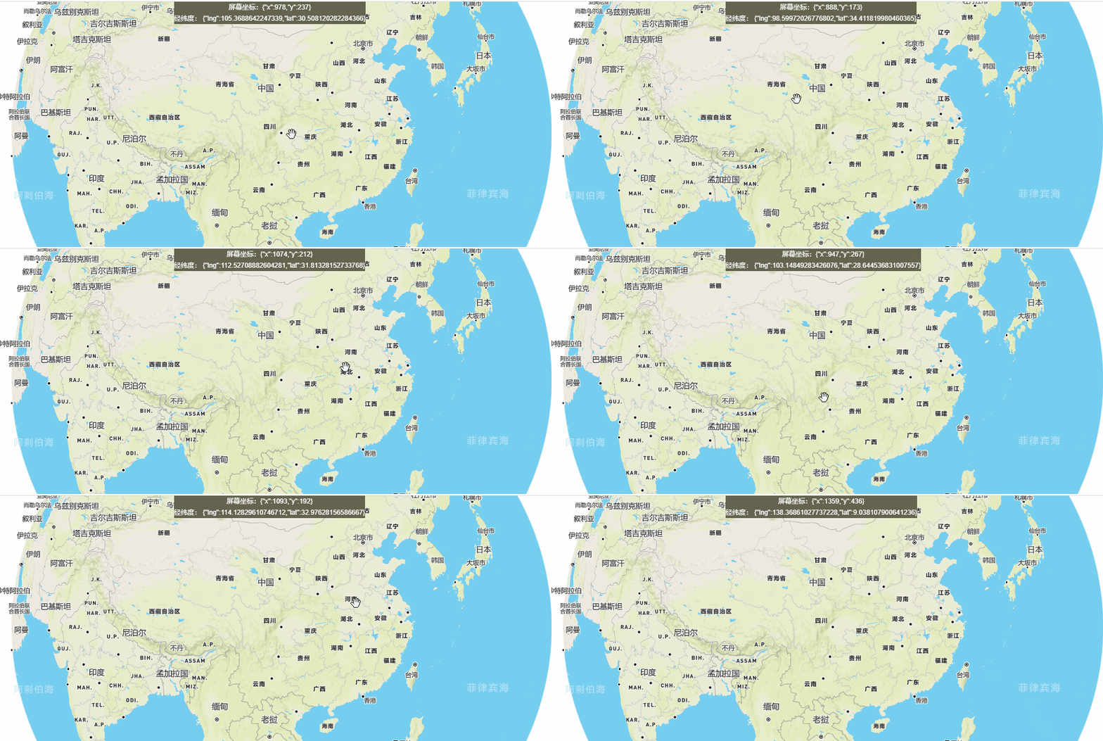
2、获取并显示鼠标移动位置的经纬度坐标
通过鼠标移动,获取实时的屏幕坐标和经纬度坐标:
    <div style="z-index: 9999; position: absolute; left:40%; background-color: rgb(100, 100, 79);color: #ffff;">
       <span>屏幕坐标:{{screenxy}}<br />经纬度: {{lnglat}}</span>
    </div>
data中定义两个值:
      //屏幕xy位置
      screenxy:"",
      //经纬度
      lnglat:null
初始化map方法中加上鼠标移动的监听事件:
      //获取鼠标位置
      map.on('mousemove', (e) => {
        this.screenxy = JSON.stringify(e.point)
        this.lnglat = JSON.stringify(e.lngLat)

      });
效果:
3、添加图标
3.1、添加图片图层的图标
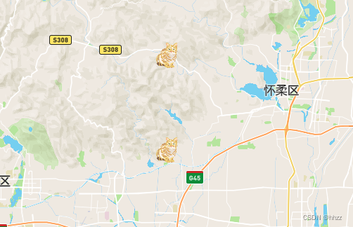
首先通过一个图像的url地址添加图片到map中,图像名称起名iconImage;其次定义一个数组features,里面包括两个点的地理信息;然后将features数组通过map的addsource接口添加到map中,数据源的名称起为iconImage,数据源类型为geojson,里面的数据类型为FeatureCollection;最后添加图层,类型是symbol,数据源是iconImage。
      //添加图片图层的图标
      map.on('load',()=>{
        map.loadImage('https://docs.mapbox.com/mapbox-gl-js/assets/cat.png',(error,image)=>{
          if(error) throw error;
          map.addImage('iconImage',image);

          let features = [{
             "type": "Feature",
                    "geometry": {
                    "type": "Point",
                    "coordinates": [116.469000,40.251706]
                  }
                }, {
                    "type": "Feature",
                    "geometry": {
                    "type": "Point",
                    "coordinates": [116.469000,40.351706]
                  }
          }]

          map.addSource('iconImage',{
             type: 'geojson',
              data: {
                type: 'FeatureCollection',
                features
              }
          })

          map.addLayer({
            id: "iconImage",
            type: "symbol",
            source: 'iconImage', // 对应addSource第一个参数名字
            layout: {
              "icon-image": "iconImage", // 对应addImage()第一个参数名字
              "icon-size": 0.1,//图标的大小
            },
          })
        })
      })
3.2、添加带有标记的自定义图标
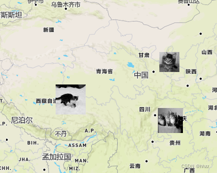
首先定义个FeatureCollection类型的对象,里面包括features的数组,里面包括三个点的feature;其次dom中创建一个div元素,通过遍历geojson中features数组给div元素赋值,也可以给div元素添加click事件;最后添加marker;
      //geojson数据
      const geojson = {
        type: "FeatureCollection",
        features: [
          {
            type: "Feature",
            properties: {
              message: "Foo",
              iconSize: [60, 60],
            },
            geometry: {
              type: "Point",
              coordinates: [91.324462, 32.024695],
            },
          },
          {
            type: "Feature",
            properties: {
              message: "Bar",
              iconSize: [50, 50],
            },
            geometry: {
              type: "Point",
              coordinates: [106.21582, 29.971891],
            },
          },
          {
            type: "Feature",
            properties: {
              message: "Baz",
              iconSize: [40, 40],
            },
            geometry: {
              type: "Point",
              coordinates: [106.292236, 37.281518],
            },
          },
        ],
      };

      // Add markers to the map.
      for (const marker of geojson.features) {
        // Create a DOM element for each marker.
        const el = document.createElement("div");
        const width = marker.properties.iconSize[0];
        const height = marker.properties.iconSize[1];
        el.className = "marker";
        el.style.backgroundImage = `url(https://placekitten.com/g/${width}/${height}/)`;
        el.style.width = `${width}px`;
        el.style.height = `${height}px`;
        el.style.backgroundSize = "100%";

        el.addEventListener("click", () => {
          window.alert(marker.properties.message);
        });

        // Add markers to the map.
        new this.$mapboxgl.Marker(el)
          .setLngLat(marker.geometry.coordinates)
          .addTo(map);
      }
3.3、悬停时显示弹出窗口
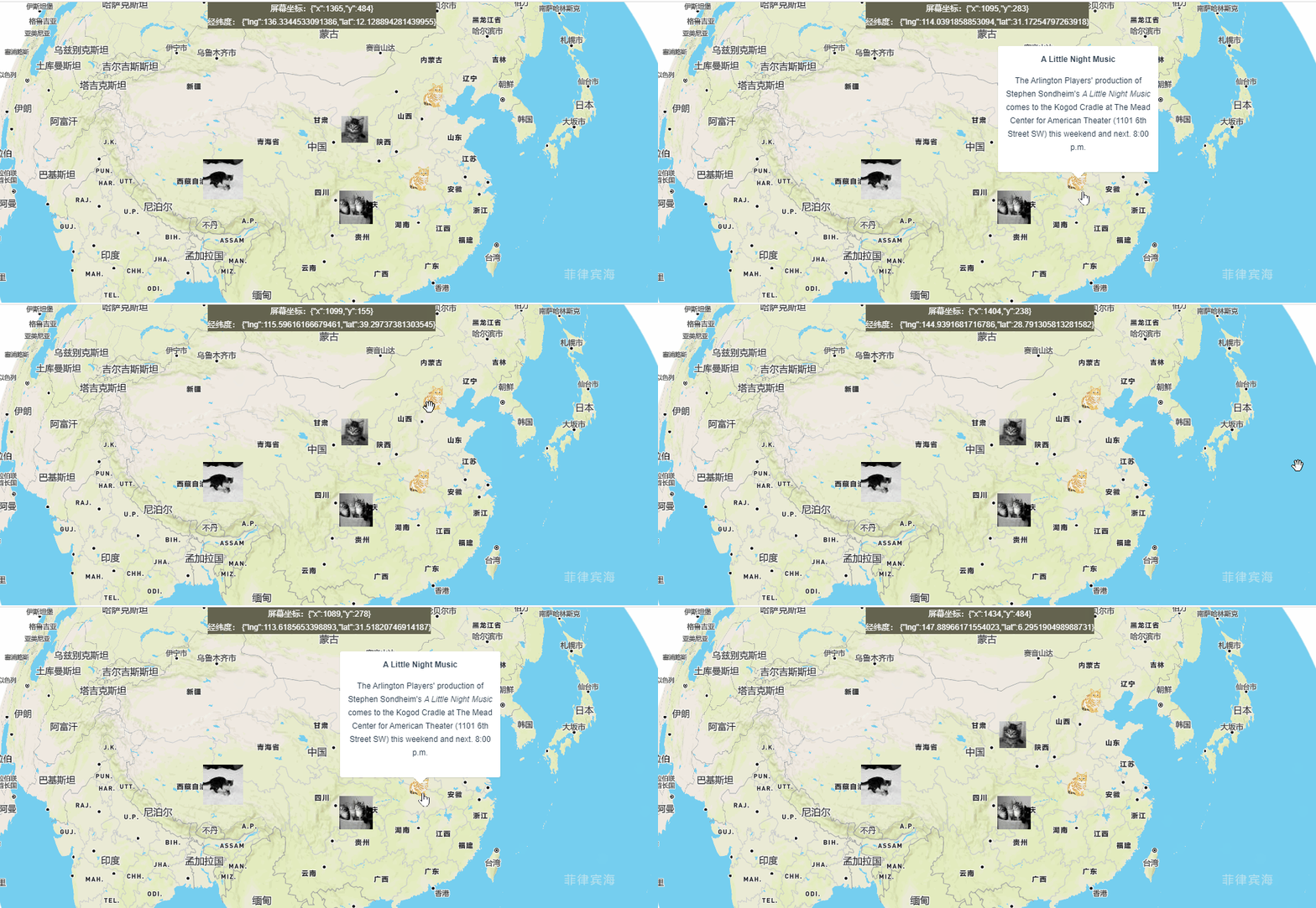
将鼠标悬停在自定义标记上时,显示包含信息的弹窗。
修改3.1中的图层数据,添加properties信息:
let features = [
              {
                type: "Feature",
                geometry: {
                  type: "Point",
                  coordinates: [116.469, 40.251706],
                },
                properties: {
                  description:
                    "<strong>A Little Night Music</strong><p>The Arlington Players' production of Stephen Sondheim's <em>A Little Night Music</em> comes to the Kogod Cradle at The Mead Center for American Theater (1101 6th Street SW) this weekend and next. 8:00 p.m.</p>"
                },
              },
              {
                type: "Feature",
                geometry: {
                  type: "Point",
                  coordinates: [113.469, 32.351706],
                },
                properties: {
                  description:
                    "<strong>A Little Night Music</strong><p>The Arlington Players' production of Stephen Sondheim's <em>A Little Night Music</em> comes to the Kogod Cradle at The Mead Center for American Theater (1101 6th Street SW) this weekend and next. 8:00 p.m.</p>"
                },
              },
            ];
添加弹窗核心代码:
// Create a popup, but don't add it to the map yet.
      const popup = new this.$mapboxgl.Popup({
        closeButton: false,
        closeOnClick: false
      });

      map.on('mouseenter', 'iconImage', (e) => {
      // Change the cursor style as a UI indicator.
      map.getCanvas().style.cursor = 'pointer';

      // Copy coordinates array.
      const coordinates = e.features[0].geometry.coordinates.slice();
      const description = e.features[0].properties.description;

      // Ensure that if the map is zoomed out such that multiple
      // copies of the feature are visible, the popup appears
      // over the copy being pointed to.
      while (Math.abs(e.lngLat.lng - coordinates[0]) > 180) {
        coordinates[0] += e.lngLat.lng > coordinates[0] ? 360 : -360;
      }

      // Populate the popup and set its coordinates
      // based on the feature found.
      popup.setLngLat(coordinates).setHTML(description).addTo(map);
      });

      map.on('mouseleave', 'iconImage', () => {
        map.getCanvas().style.cursor = '';
        popup.remove();
      });
效果展示:
其他鼠标以及地图飞行平移事件方法:
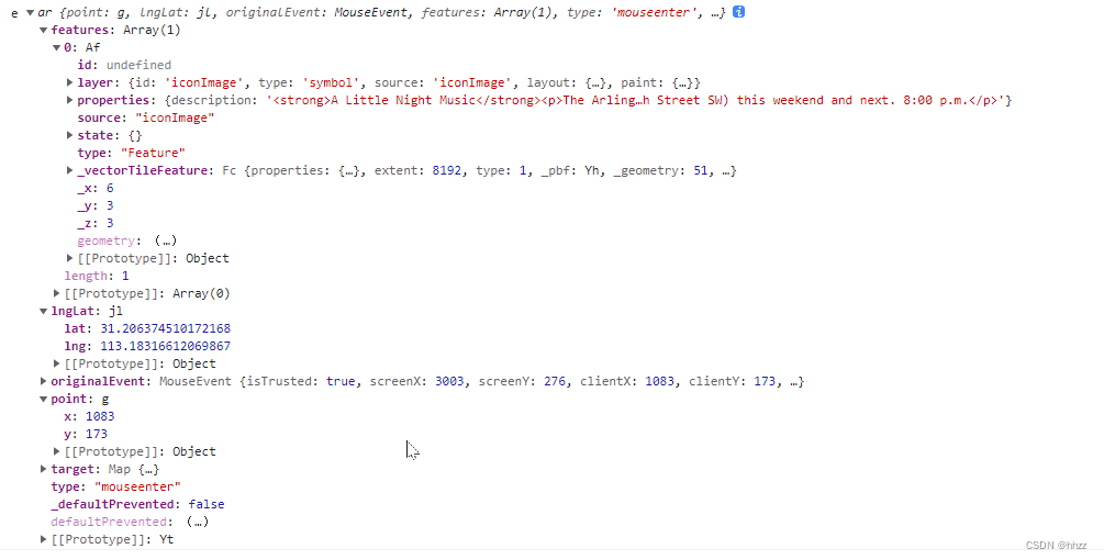
- 鼠标经过事件
map.on('mouseenter', 'addLayer的id值', (e) => {
    console.log('e', e);
});
打印输出结果:
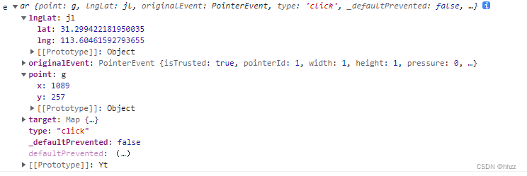
- 鼠标点击事件
map.on('click', 'addLayer的id值', (e) => {
    console.log('e', e);
});
打印输出结果:
- 地图平移
// center为要平移的坐标,zoom为平移的缩放级别
map.flyTo({ center:[116.00, 39.48], zoom: 9 });


