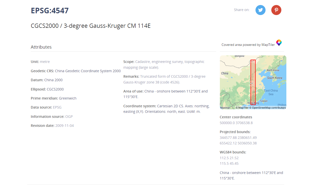
1.首先查看坐标系基础信息如范围等:如下图:
2.若将地图设置成4547坐标系:
核心代码:
    proj4.defs(
      "EPSG:4547",
      "+proj=tmerc +lat_0=0 +lon_0=114 +k=1 +x_0=500000 +y_0=0 +ellps=GRS80 +units=m +no_defs +type=crs"
    );
    register(proj4);
    const projection = new Projection({
      code: "EPSG:4547",
      units: "metre",
      extent: [344577.88, 2380651.49, 655422.12, 5036050.38],
    });
    var map = new Map({
      target: "map",
      view: new View({
        center: [495186.517, 2496151.273600001],
        zoom: 2,
        projection: projection,
      }),
      layers: [
        new TileLayer({
          className: "baseLayerClass",
          source: new Tianditu({
            key: "1d109683f4d84198e37a38c442d68311",
            projection: projection
          }),
        }),
      ],
    });
最后你将得到一个如下图所示的地图:
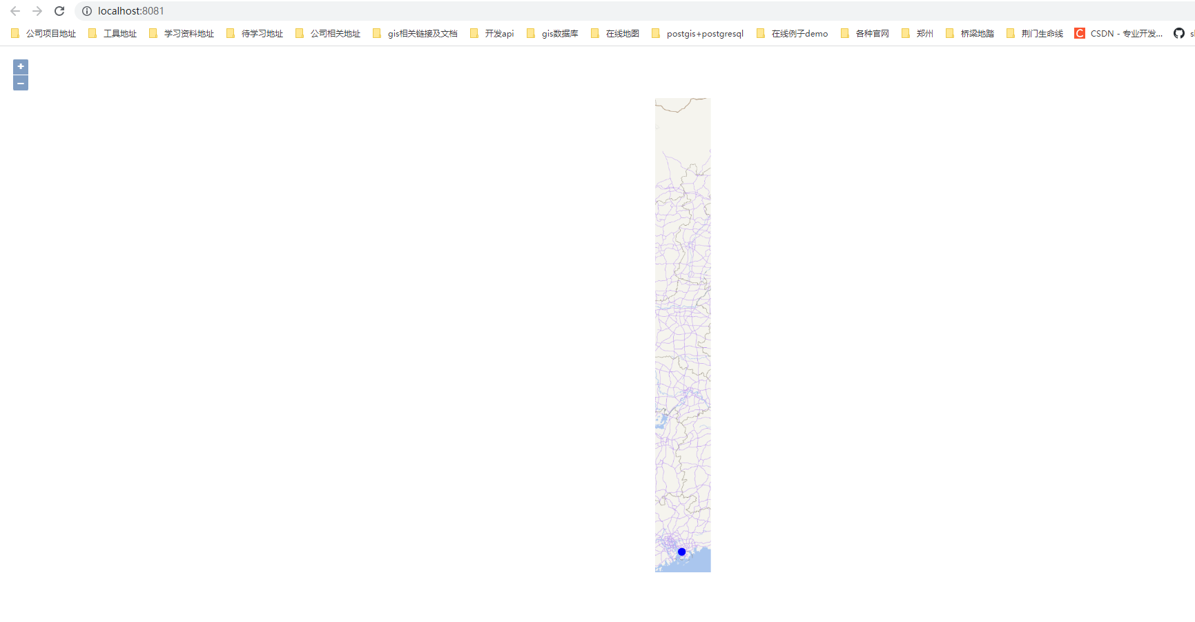
这样的地图就是4547坐标系
3.若要加载4547坐标系的wfs数据:
如下图所示,wfs查询后返回的数据:为4547的数据,这点也可以在wfs服务的xml文件中查看的到:
wfs服务返回的数据如下图所示:


wfs服务的xml如下图所示:可以看到数据是4547坐标系(这里是超图的wfs服务)

4.核心加载代码:
    const vectorSource = new VectorSource({
      format: new GeoJSON(),
      loader:function(extent, resolution, projection, success, failure) {
     const proj = projection.getCode();
     const url = wfsUrl;
     const xhr = new XMLHttpRequest();
     xhr.open('GET', url);
     const onError = function() {
       vectorSource.removeLoadedExtent(extent);
       failure();
     }
     xhr.onerror = onError;
     xhr.onload = function() {
       if (xhr.status == 200) {
         const features = vectorSource.getFormat().readFeatures(xhr.responseText,{
          dataProjection:"EPSG:4547",
          // featureProjection:"EPSG:4547",
         });
        //  const features = vectorSource.getFormat()
        //  console.log('这是features',features);
         vectorSource.addFeatures(features);
         success(features);
       } else {
         onError();
       }
     }
     xhr.send();
   },
    });

    const vector = new VectorLayer({
      source: vectorSource,
      style: new Style({
        stroke: new Stroke({
          color: "rgba(0, 0, 255, 1.0)",
          width: 10,
        }),
      }),
    });
5.注意:readFeatures 的 dataProjection和featureProjection属性,若你的地图设置的是4326坐标系则需要设置为:即源数据为4547,转换数据为4326,则可在4326的地图上绘制出4547的数据。
{
          dataProjection:"EPSG:4547",
          featureProjection:"EPSG:4326",
}
6.这里我放置一下wfs服务链接,仅供参考使用超图wfs的小伙伴,(其中token为用户自己的超图服务token)
https://ditu.yjgl.sz.gov.cn:8443/iserver/services/data-GD_SZ_YWSJ_CIMGXY/wfs200?token=token&version=2.0.0&count=10000&service=WFS&request=GetFeature&outputFormat=json&typenames=GD_SZ_YWSJ_CIMGXY:排水渠
其余server服务小伙伴参考3的数据返回格式,是一样的返回geojson格式的数据即可。
7.openlayer 注册坐标系:注册了之后可使用 “EPSG:4547”,例如4代码中的dataProjection:“EPSG:4547”
    proj4.defs(
      "EPSG:4547",
      "+proj=tmerc +lat_0=0 +lon_0=114 +k=1 +x_0=500000 +y_0=0 +ellps=GRS80 +units=m +no_defs +type=crs"
    );
    register(proj4);
8.openlayer 生成projection,例如2代码中的projection: projection,
    const projection = new Projection({
      code: "EPSG:4547",
      units: "metre",
      extent: [344577.88, 2380651.49, 655422.12, 5036050.38],
    });
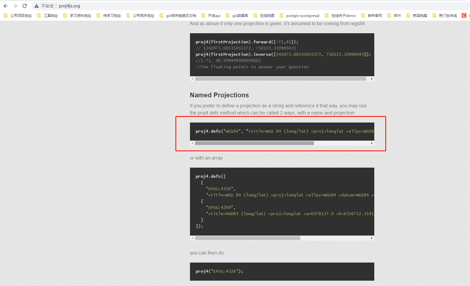
9.proj4
http://proj4js.org/
npm 安装后 import proj4 from “proj4” 即可
npm install proj4
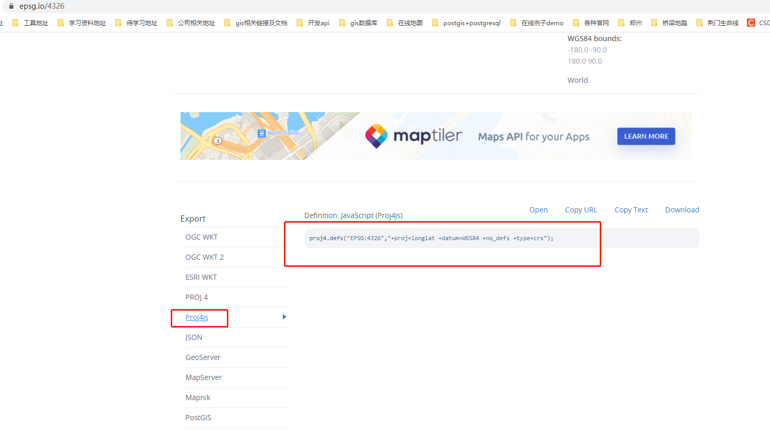
10.坐标系proj4可在EPSG官网查看复制:
https://epsg.io/
11.具体坐标系相关可跳转至另外一篇博文:
点击跳转