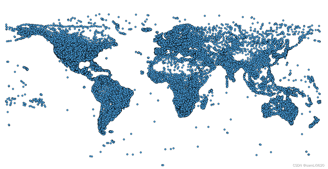
数据来源:自主整理
时间跨度:更新至2022
区域范围:全球各国
指标说明:
全球机场坐标数据,包含CSV格式、shpfile格式、kml格式属性字段包括机场类型、经纬度,高程,所在国家省市区域,机场名称.
数据字段:
id ident type name latitude_deg longitude_deg elevation_ft continent iso_country iso_region municipality scheduled_service gps_code iata_code local_code home_link wikipedia_link keywords

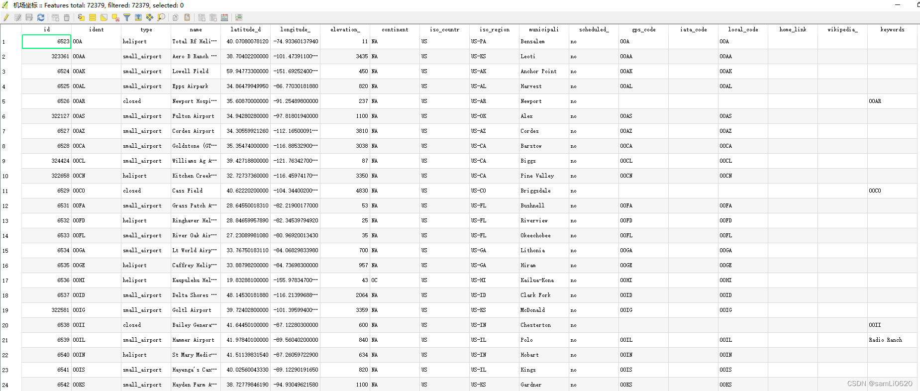
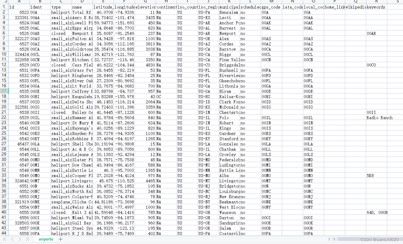
| id | ident | type | name | latitude_deg | longitude_deg | elevation_ft | continent | iso_country | iso_region | municipality | scheduled_service | gps_code | iata_code | local_code | home_link | wikipedia_link | keywords |
| 6523 | 00A | heliport | Total Rf Heliport | 40.07080078 | -74.93360138 | 11 | NA | US | US-PA | Bensalem | no | 00A | 00A | ||||
| 323361 | 00AA | small_airport | Aero B Ranch Airport | 38.704022 | -101.473911 | 3435 | NA | US | US-KS | Leoti | no | 00AA | 00AA | ||||
| 6524 | 00AK | small_airport | Lowell Field | 59.947733 | -151.692524 | 450 | NA | US | US-AK | Anchor Point | no | 00AK | 00AK | ||||
| 6525 | 00AL | small_airport | Epps Airpark | 34.8647995 | -86.77030182 | 820 | NA | US | US-AL | Harvest | no | 00AL | 00AL | ||||
| 6526 | 00AR | closed | Newport Hospital & Clinic Heliport | 35.6087 | -91.254898 | 237 | NA | US | US-AR | Newport | no | 00AR | |||||
| 322127 | 00AS | small_airport | Fulton Airport | 34.9428028 | -97.8180194 | 1100 | NA | US | US-OK | Alex | no | 00AS | 00AS | ||||
| 6527 | 00AZ | small_airport | Cordes Airport | 34.30559921 | -112.1650009 | 3810 | NA | US | US-AZ | Cordes | no | 00AZ | 00AZ |
数据下载链接:https://download.csdn.net/download/samLi0620/87387340
