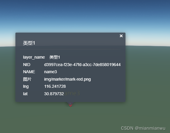
遍历取后端数据推送到地图上,实现图标点标记地图效果

示例链接:
功能示例(Vue版) | Mars3D三维可视化平台 | 火星科技
踩坑注意点:
1. id: 1 是地图底图的id 后台也返回之后 id直接会有冲突 此时图标标记之后无法单击
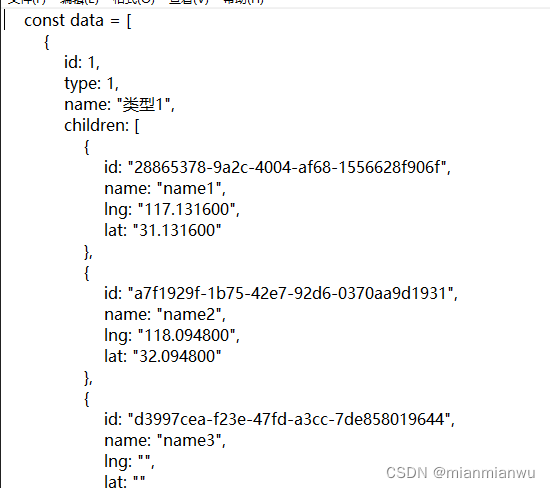
相关代码:
import * as mars3d from "mars3d"
export let map


function initMap() {
  // 读取 config.json 配置文件
  return mars3d.Util.fetchJson({ url: "config/config.json" }).then(function (mapOptions) {
    if (mapOptions.map3d) {
      mapOptions = mapOptions.map3d
    }
   // 创建三维地球场景
    map = new mars3d.Map("mars3dContainer", mapOptions)

    // 打印测试信息
    console.log("mars3d的Map主对象构造完成", map)
    return map
  })
}

export function onMounted(mapInstance) {
  map = mapInstance // 记录首次创建的map
  map.basemap = []
  map.hasTerrain = false
  const data = [
    {
      id: 1,
      type: 1,
      name: "类型1",
      children: [
        {
          id: "28865378-9a2c-4004-af68-1556628f906f",
          name: "name1",
          lng: "117.131600",
          lat: "31.131600"
        },
        {
          id: "a7f1929f-1b75-42e7-92d6-0370aa9d1931",
          name: "name2",
          lng: "118.094800",
          lat: "32.094800"
        },
        {
          id: "d3997cea-f23e-47fd-a3cc-7de858019644",
          name: "name3",
          lng: "116.241728",
          lat: "30.879732"
        }
      ]
    },
    {
      id: 2,
      type: 2,
      name: "潜艇",
      children: null
    },
    {
      id: 3,
      type: 3,
      name: "飞机",
      children: null
    },
    {
      id: 4,
      type: 4,
      name: "无人系统",
      children: null
    },
    {
      id: 5,
      type: 5,
      name: "地面兵力及设施",
      children: null
    },
    {
      id: 99,
      type: 99,
      name: "其他",
      children: null
    }
  ]
  data.forEach((item, index) => {
    console.log("index", index)
    // 处理聚合点对象外层配置信息
    let itemobj = {}
    // 如有children有数据 动态在图层中增加点集合
    if (item.children != null) {
      // 如果有children创建点聚合对象
      itemobj = {
        type: "FeatureCollection",
        crs: {
          type: "name",
          properties: {
            name: "EPSG:4490"
          }
        },
        features: []
      }
      item.children.forEach((childrenitem, chukdrenindex) => {
        let itemobjfeatures = {}
        itemobjfeatures = {
          type: "Feature",
          id: childrenitem.id,
          geometry: {
            type: "Point",
            coordinates: [childrenitem.lng, childrenitem.lat]
          },
          properties: {
            OBJECTID: childrenitem.id,
            NID: childrenitem.id,
            NAME: childrenitem.name,
            图片: "img/marker/mark-red.png",
            lng: childrenitem.lng,
            lat: childrenitem.lat
          }
        }
        itemobj.features.push(itemobjfeatures)
        console.log(itemobj)
      })
    }

  const  separateobj = {
      id: item.type,
      name: item.name,
      // 点聚合数据
      data: itemobj,
      symbol: {
        styleOptions: {
          image: "img/marker/mark-red.png",
          verticalOrigin: Cesium.VerticalOrigin.BOTTOM,
          scale: 1,
          scaleByDistance: true,
          scaleByDistance_far: 20000,
          scaleByDistance_farValue: 0.5,
          scaleByDistance_near: 1000,
          scaleByDistance_nearValue: 1,
          label: {
            text: "{NAME}",
            font_size: 25,
            color: "#ffff00",
            font_family: "微软雅黑",
            outline: true,
            outlineColor: "#000000",
            pixelOffsetY: -40,
            scaleByDistance: true,
            scaleByDistance_far: 1000000,
            scaleByDistance_farValue: 0.5,
            scaleByDistance_near: 1000,
            scaleByDistance_nearValue: 1,
            distanceDisplayCondition: true,
            distanceDisplayCondition_far: 1000000,
            distanceDisplayCondition_near: 0,
            visibleDepth: true
          }
        }
      },
    popup: "all",
    // popup: [
    //   { field: "NAME", name: "名称" },
    //   { type: "details", callback: "showPopupDetails", field: "图片", className: "mars3d-popup-btn-custom" }
    // ],
    // popup: [
    //   { field: "NAME", name: "名称" },
    //   { type: "details", field: "图片", name: "image" },
    //   {
    //     type: "html",
    //     html: "<label>视频</label><video src='http://data.mars3d.cn/file/video/lukou.mp4' controls autoplay style=\"width: 300px;\" ></video>"
    //   }
    // ],
      show: true
    }

    const geoJsonLayer = new mars3d.layer.GeoJsonLayer(separateobj)
    map.addLayer(geoJsonLayer)
    console.log("geoJsonLayer", geoJsonLayer)
  })

}

![Amazon云计算AWS之[1]基础存储架构Dynamo](https://img-blog.csdnimg.cn/direct/0bd82ce343354d1a9881ebbfd7443378.png#pic_center)
