因为企业级地理信息数据库(sde库)需要官方许可(这里不讨论破解,对于商业项目,没啥意义),所以自然的想到使用postgis平替sde库,虽然没有sde库那么强大和方便,但是能实现很多想要的功能。
技术路线:
数据库:postgresql+postgis
gis软件:qgis
前端:arcgis js api
后端:spring boot
第一步:
在qgis里连接postgresql数据库,并导入shp文件,或者自己创建图层(坐标系采用4326,没有强制要求坐标系,只是这个坐标系比较方便使用)。
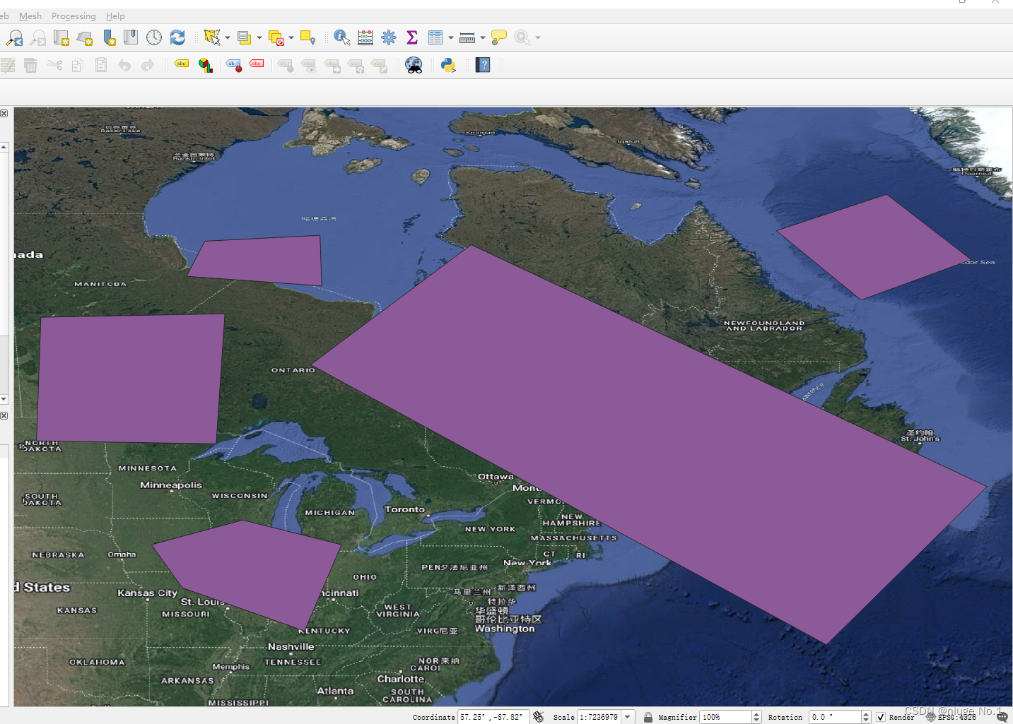
第二步:后端代码(实现将几何通过geojson的方式返回至前端)
@Autowired
    private JdbcTemplate jdbcTemplate;

    @Override
    public List getAllGeometry(String layerName) {
        return jdbcTemplate.queryForList(String.format("select ST_AsGeoJSON(geom) from %s",layerName));
    }
第三步:前端加载转换几何并加载
            const url = 'xxxx(你自己的后端接口)'
            esriRequest(url, {
                responseType: 'json'
            }).then(function (response) {
                // The requested data
                console.log(response.data)
                let i = 0
                response.data.forEach((element) => {
                    const geoJson = JSON.parse(element.st_asgeojson)
                    let geometry = null
                    if (geoJson.type === 'Point') {
                        geometry = new Point({
                            x: geoJson.coordinates[0],
                            y: geoJson.coordinates[1],
                            z: geoJson.coordinates[2],
                        })
                    } else if (geoJson.type === 'MultiPolygon') {
                        geometry = new Polygon({
                            rings: geoJson.coordinates[0]
                        })
                    }
                    if (geometry) {
                        const graphic = new Graphic({
                            geometry: geometry,
                            attributes: {
                                ObjectID: i
                            }
                        })
                        i++
                        source.push(graphic)
                    }
                })
                const test = new FeatureLayer({
                    id: 'test',
                    objectIdField: 'ObjectID',
                    elevationInfo: {
                        mode: 'on-the-ground'
                    },
                    source
                })
                view.map.add(test)
                view.when(() => {
                    view.goTo(test.fullExtent)
                })
            })
最终实现效果:
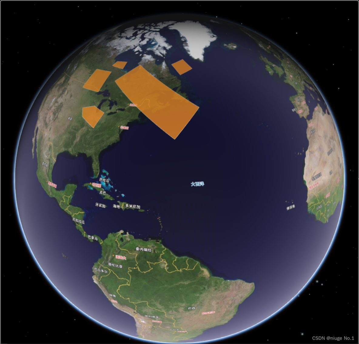
以上思路完美实现arcgis对postgis的支持,并且不需要许可,实现自己的地理信息数据库。

![[4]PCB设计实验|LPWAN物联网系统解决方案 |LoRa模块/LoRa网关/云平台/LoRa应用案例|9:30~10:00](https://img-blog.csdnimg.cn/6cb9d7d0af104fd9862817ac73ef30bb.png)

