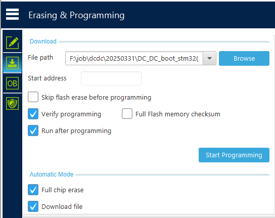
一、实现效果
输入中心点坐标及半径,绘制半球形区域,地下部分不显示。
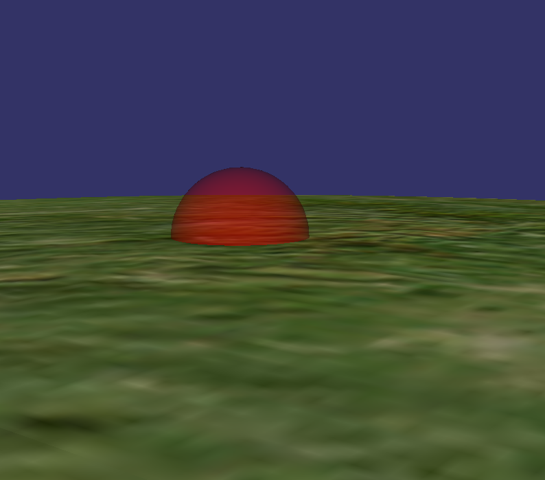
二、实现原理
根据中心点及半径绘制半球形区域,将其挂接到地球节点。
三、参考代码
void GlobeWidget::drawSphericalRegion(osg::Vec3d point,double radius)
{
    // 使用 osgEarth 转换经纬度到地球坐标
    osgEarth::GeoPoint geoPoint(osgEarth::SpatialReference::get("wgs84"),
        point.x(), point.y(), 0.0, osgEarth::ALTMODE_ABSOLUTE);
    osg::Vec3d worldPoint;
    geoPoint.toWorld(worldPoint);  // 转换为地球坐标系

    // 创建一个球体
    osg::ref_ptr<osg::Sphere> sphere = new osg::Sphere(worldPoint, radius);
    osg::ref_ptr<osg::ShapeDrawable> shape = new osg::ShapeDrawable(sphere);

    // 设置材质颜色
    shape->setColor(osg::Vec4(1.0f, 0.0f, 0.0f, 0.5f)); // 红色,半透明

    osg::ref_ptr<osg::Geode> geode = new osg::Geode();
    geode->addDrawable(shape);

    // 启用透明混合
    geode->getOrCreateStateSet()->setMode(GL_BLEND, osg::StateAttribute::ON);
    geode->getOrCreateStateSet()->setRenderingHint(osg::StateSet::TRANSPARENT_BIN);

    // 添加到根节点
    m_userDrawGroup->addChild(geode);
}


![[react]Next.js之自适应布局和高清屏幕适配解决方案](https://i-blog.csdnimg.cn/direct/4494b56f3c2b419681cb1cdf6d04361d.png)