一、需求
使用GeoServer发布的WMS服务对WMS做空间范围查询,默认情况下WMS支持点击查询,网上有很多的资料不在赘述。那么WMS做几何查询该怎么实现呢?
二、实现路径
查询WMS查询的服务参数,WMS支持三种请求方式:GetCapabilities、GetMap、GetFeatureInfo。其中GetCapabilities获取WMS服务的元数据信息,GetMap用于出图;GetFeatureInfo获取属性信息,我们查询需要的是GetFeatureInfo请求方式,参数结果如下:
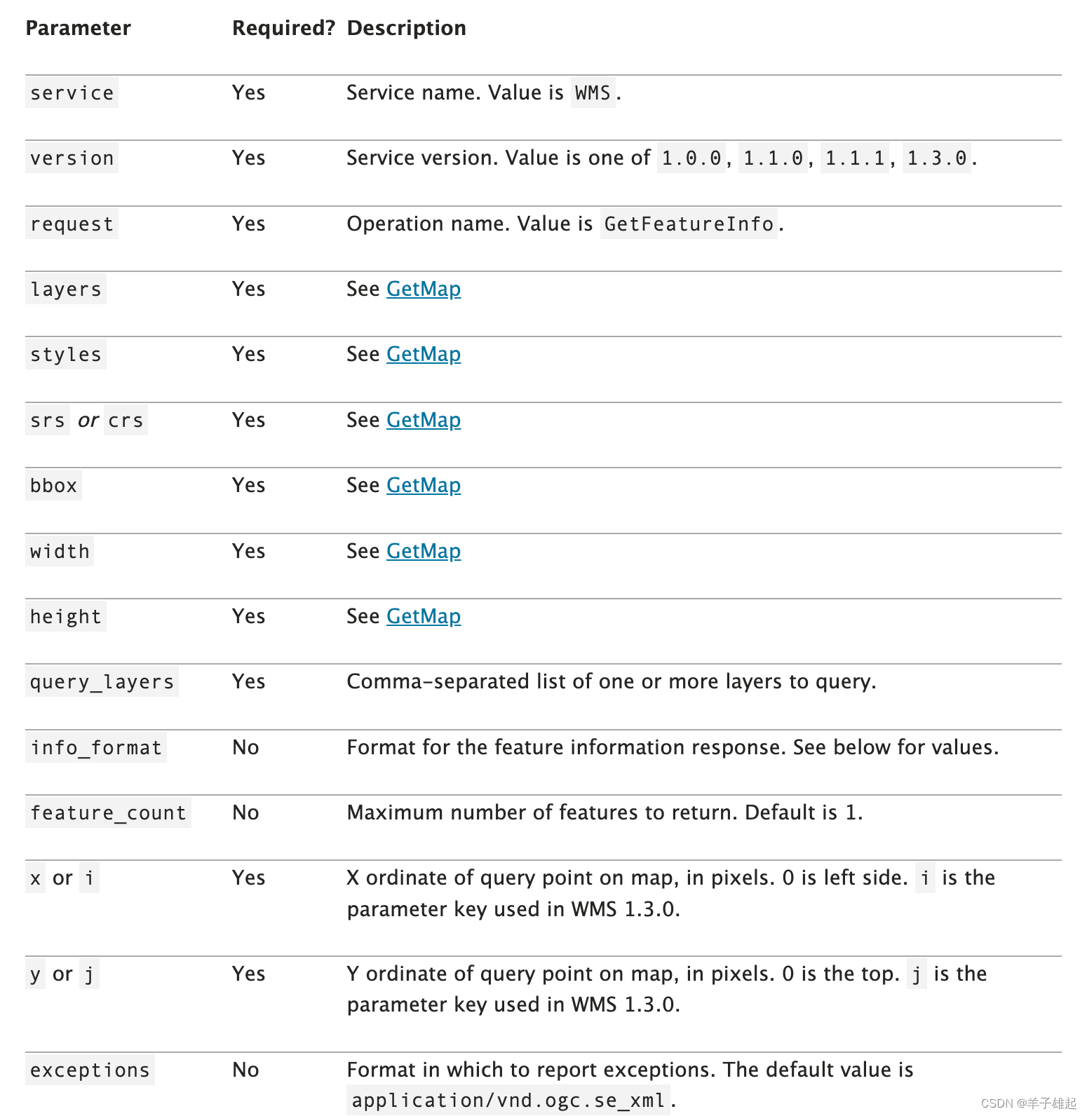
GetFeatureInfo操作请求地图上给定位置处要素的空间和属性数据。它类似于WFS GetFeature操作,但在输入和输出方面不太灵活。由于 GeoServer 提供了 WFS 服务,我们建议尽可能使用它GetFeatureInfo。
其优点之一GetFeatureInfo是请求使用返回的WMS图像中的 (x,y) 像素值。对于无法执行真实地理参考的天真的客户端来说,这更容易使用。
这里面大部分的都是跟出图参数相关的参数,重点关注x和y这两个参数,使用的像素坐标值,需要用leaflet进行转化。
空间查询的参数主要是以下几个:
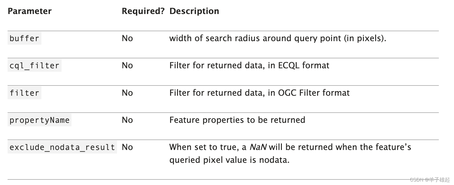 通过buffer可以做缓冲半径查询,通过cql_filter可以对返回的结果进行过滤,它支持ECQL格式,可以使用wkt语言文本格式传入空间条件,如下所示:
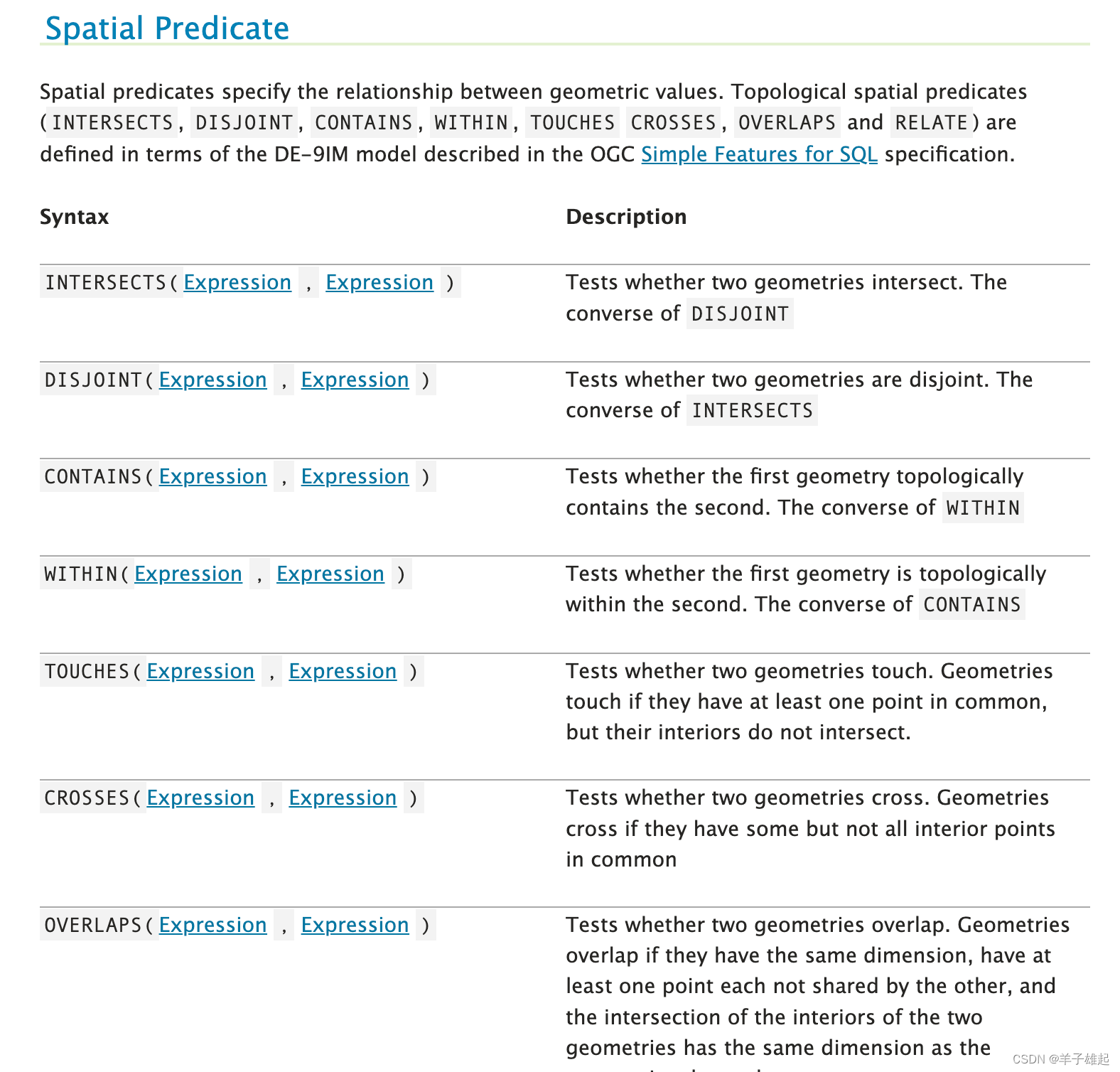
所以空间几何查询思路如下:
- 获取当前地图绘制的几何范围
- 获取几何范围的最大外接矩形
- 计算缓冲半径,进行空间查询
- 通过cql_filter过滤空间范围的结果
- 结果渲染、实现路径
三、代码实现
1、获取地图视窗的范围和宽高
// 获取地图视窗bounds
            const mapBounds = map.getBounds();
            const bbox = `${mapBounds._southWest.lng},${mapBounds._southWest.lat},${mapBounds._northEast.lng},${mapBounds._northEast.lat}`;
            // 获取地图视窗的宽高
            const mapClientHeight = map._container.clientHeight;
            const mapClientWidth = map._container.clientWidth;

            const size = map.getSize();
2、获取当前地图绘制的几何范围和外接矩形
// 获取geometry的最小外包矩形
                const geoBounds = geo.getBounds();
                params.BBOX = geoBounds.toBBoxString();
                // 计算四个点的像素位置
                // 右上角
                const _northEast = geoBounds._northEast;
                // 左下角
                const _southWest = geoBounds._southWest;
                // 转为屏幕坐标
                let northEastPoint = map.latLngToContainerPoint(_northEast, map.getZoom());
                let southWestPoint = map.latLngToContainerPoint(_southWest, map.getZoom());
3、根据外接矩形的宽高计算缓冲半径
// x,y坐标差
                const xf = Math.abs(northEastPoint.x - southWestPoint.x);
                const yf = Math.abs(southWestPoint.y - northEastPoint.y);
                // 设置图片的宽高,为x,y坐标差
                params.width = Math.floor(xf);
                params.height = Math.floor(yf);
                // 以图片宽高的一半为中心点
                params.X = Math.round(xf / 2);
                params.Y = Math.round(yf / 2);
                // 设置以中心点为圆心的缓冲半径(像素)
                // 以x,y屏幕坐标差大的设置buffer参数

                const buffer = xf > yf ? xf : yf;
                params.buffer = Math.round(buffer / 2);
3、拼接cql_filter过滤空间范围
// geojson 跟 wkt 相互转换
                const wktReader = new Wkt.Wkt();
                const wkt = wktReader.read(JSON.stringify(geometry));
                // 二次过滤,设置过滤的空间范围
                params.CQL_FILTER = `INTERSECTS(the_geom,${wkt.write()})`;
            }
4、查询返回结果
$.ajax({
                url: url + L.Util.getParamString(params),
                success: (response) => {
                    console.log(response);
                    queryResultLayers.addLayer(L.geoJSON(response))
                }
            })
参考资料:
ECQL Reference — GeoServer 2.23-SNAPSHOT User Manual

